The Chyulu Hills are a relatively young volcanic field in geological terms.
They stretch for around a hundred kilometres and are comprised of hundreds of small cones and flows. The most recent eruptions were in 1855 AD and before that sometime during the European Renaissance. However, volcanic activity began forming this geographic feature roughly 1.4 million years ago. Rising to over 2000 metres, they now form a crucial water catchment for the Tsavo ecosystem.
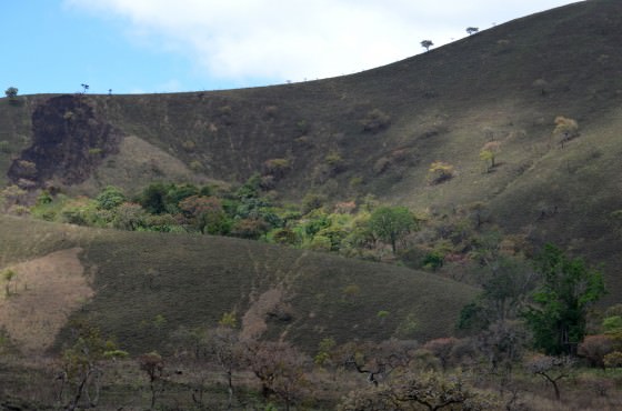
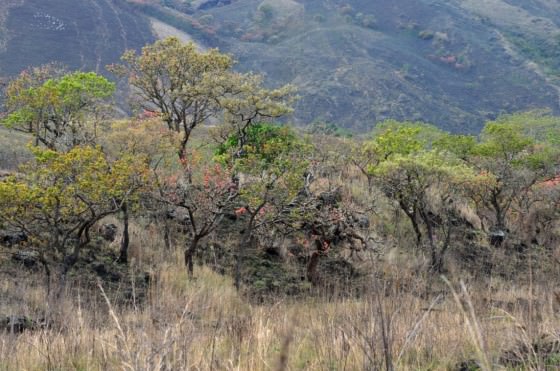
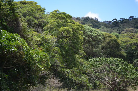
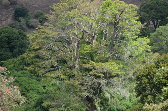
Warm, moist air moving inland from the coast is pushed up the side of the southeast end of the Chyulus cooling and condensing as it reaches the crests of mountain ridges where it forms patches of thick forest. These forest caps sit like desert islands atop a sea of open grassland, their edges so clearly defined it seems there is some invisible boundary which prevents their advance. In actuality, the forests are kept from spreading, at least in part, by annual bushfires, which are intentionally set by herdsmen to kill off the dead grass and scrubland to encourage the growth of fresh shoots. The practice is highly effective for creating fertile, productive grazing and has been used for hundreds of years by Maasai pastoralists; however, it does little to improve biodiversity.

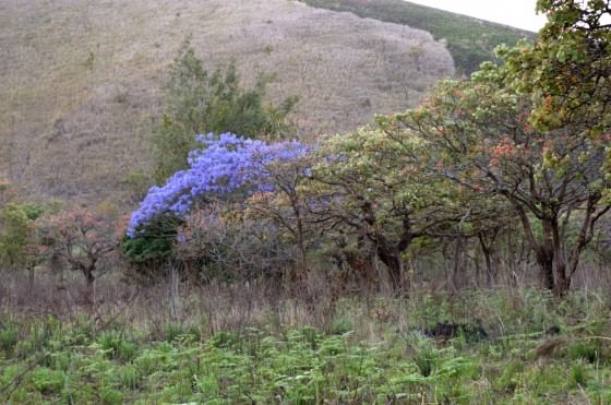
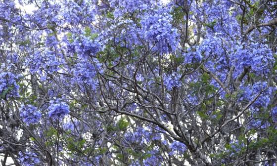
Each year, thousands of birds, insects, small mammals, plants and trees die as a result of uncontrolled bushfires, and the forests, which might otherwise continue covering the hills, are halted in their tracks. Unfortunately, managing this activity is difficult. The Chyulu hills have only been protected under the management of Kenya Wildlife Services (KWS) since 1983 when President Daniel Toroitich Arap Moi gazetted the Park in order to protect the cloud forests. Before 1983, human settlement had begun to occur in the area, the evidence of which still remains. A derelict house appears as you climb the hill towards the summit, and exotic fruit trees such as guavas, mangos and avacados adorn the landscape. Oddly, these trees do not appear all that out of place anymore and have blended into the surrounding vegetation. Even a lone jacaranda, native to Brazil, standing at the end of an old avenue of Erythrina abysinnica, looks at home in a small valley below a ridge. In full purple bloom, the jacaranda forms a beautiful accent against the muted backdrop. The consequence of such recent settlement is the continuing sense of dependence on the area, mainly for grazing. The grazing in and of itself is not as harmful as the method.
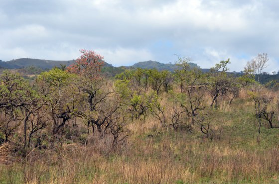
In most cases, grazing is largely unmanaged, causing overutilisation and insufficient rest to promote regeneration. Bushfires are then set to stimulate new growth with the unintended consequence of both burning organic nutrient and eroding the recently parched earth during heavy rains, which then washes away mineral-rich volcanic ash. Soil quality is continually depleted rather than being continually improved by subsequent layers of decomposing, organic matter.
Despite this, the Chyulus are still highly efficient at capturing water. The porous, volcanic hills suck up precipitation like a giant sponge, with water percolating into a reservoir from which water works its way out along the interface between the volcanics and the underlying Basement, emerging as springs at the tips of lava tongues that filled river valleys in the old land surface. These springs are clustered in the north and at Mzima, thanks to the slopes of the underlying Basement geology. The major portion of the spring discharges is accounted for at Mzima Springs in Tsavo West National Park. Although difficult to estimate the time it takes for rain to work its way into and out of the Chyulus, in part because of sparse rainfall figures from atop the Chyulus, the data that does exist seems to indicate a three year lag between heavy rainfall and increased discharge at Mzima.
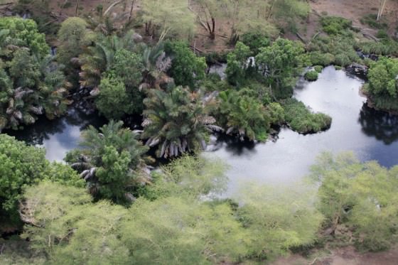
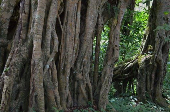
DSWT manages the Kibwezi Forest, which is sustained by groundwater also derived from the Chyulus. At the heart of the forest flow Umani Springs, home to fish, amphibians, crocodiles, and enormous rock pythons that in Wakamba tradition are considered deities charged to protect and control water. Even today, Wakamba elders offer up goat sacrifices to pythons once a year in a plea to keep the springs from drying up.
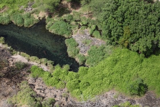
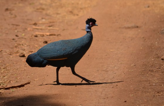
Aside from animals that live in and around the springs, a plethora of other creatures depend on them for water and can be spotted regularly quenching themselves from crystal clear water as it emerges from volcanic rock. Among them are elephant, buffalo, baboon, leopard, vervet monkeys, bushbuck, duiker, the very shy crested guinea fowl, as well as hundreds of other bird species, and a host of various small mammals, insects and reptiles. Huge ficus trees suck up moisture from the springs and surrounding ground water and offer respite from the harsh Tsavo sun.
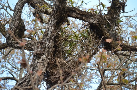
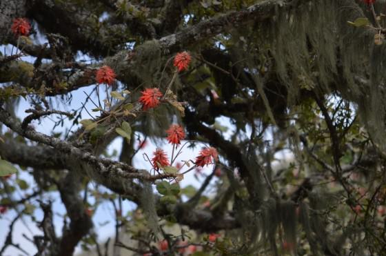
At the top of the Chyulus, although there is no standing or flowing water, montane forests are similarly rich and full of life. Rainfall is heavier here, but trees and plants are able to also soak up moisture from passing clouds and morning dew. Mosses, orchids and ferns hang from tree limbs, and rich birdsong fills the air. In fact, standing on an animal trail in the forest you might easily imagine that you are in the middle of the Aberdare rainforest, and not in the Tsavo Conservation Area.
In reflection, it is remarkable how this young volcanic ridge has transformed its corner of the world. Reaching high into the sky it captures water, stores it and then shares it out to the surrounding environs. Millions of perfectly balanced relationships are built upon this framework, beginning at the top in the cloud forests and ending at the bottom around fertile springs. In so many ways, the Chyulus affirm that water is life.
A special thanks to Sean Avery for his help describing the journey that water takes before emerging from Tsavo's springs.